
Terrace trails
Click on a trail to view its statistics, map and profile.

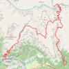
South Kaibab - Tonto - Bright Angel (Grand Canyon)
United States > Arizona > Coconino County
From Yaki Point, the route commits at once to the exposed descent of the South Kaibab Trail, a dramatic ridgeline path known for wide, open views and very little shade or water. It first reaches Ooh Aah Point, where the canyon opens suddenly in every direction, then continues through the sculpted upper…
Distance: 30.1 Km • Elevation gain: 2,293 m • Maximum elevation: 2,217 m
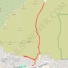
Hall Canyon
United States > California > Ventura County > San Buenaventura (Ventura)
From Hall Canyon Road, the route enters Ventura Hills Nature Preserve and follows the quiet canyon corridor between open foothill slopes. It continues along dry washes and coastal scrub typical of Ventura’s protected hillside landscape. The walk reaches the split between West Fork Hall Canyon and East Fork…
Distance: 7.5 Km • Elevation gain: 193 m • Maximum elevation: 131 m
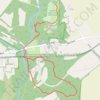
Terrace / Indian Ridge Trail
United States > Ohio > Franklin County
Distance: 5.3 Km • Elevation gain: 45 m • Maximum elevation: 288 m
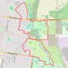
Nortons Park and Dandenong Valley Parklands loop
Australia > Victoria > Melbourne
Distance: 11.7 Km • Elevation gain: 101 m • Maximum elevation: 97 m
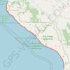
Lost Coast Trail
United States > California > Humboldt County
From Mattole Beach, the Lost Coast Trail begins on an open Pacific shoreline where sand, dunes, driftwood and low coastal vegetation lead south toward Windy Point, the Punta Gorda Light area, Cooskie Creek and Randall Creek, with the King Range rising close behind the beach and giving the route its remote,…
Distance: 41.8 Km • Elevation gain: 718 m • Maximum elevation: 53 m
Havasu Creek Falls (Fiftyfoot Falls, Navajo Falls, Havasu Falls, Mooney Falls and Beaver Falls)
United States > Arizona > Coconino County
From Hualapai Hilltop, the route drops through dry switchbacks and open desert canyon toward Supai, a remote Havasupai village set within Havasu Canyon and not accessible by road. Beyond Supai, the trail follows the blue-green waters of Havasu Creek, passing Fiftyfoot Falls and Navajo Falls before reaching the…
Distance: 23.4 Km • Elevation gain: 1,612 m • Maximum elevation: 1,580 m
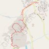
Mammoth Hot Springs Loop
United States > Wyoming > Park County > Mammoth
Starting near the Albright Visitor Center in Yellowstone National Park, this loop follows Grand Loop Road toward Palette Spring, where steaming runoff, warm mineral colors and open views introduce the Mammoth Hot Springs landscape. The route then crosses the Mammoth Terraces through Jupiter Terrace, Mound…
Distance: 4.5 Km • Elevation gain: 131 m • Maximum elevation: 2,009 m
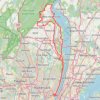
GFNY World Championship NYC 2026
United States > New Jersey > Bergen County > Fort Lee
Distance: 136.6 Km • Elevation gain: 2,449 m • Maximum elevation: 263 m
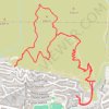
Ventura Hills Nature Preserve Trails 101 and 102 Loop
United States > California > Ventura County > Ventura
Distance: 7.8 Km • Elevation gain: 378 m • Maximum elevation: 260 m
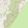
Weir Canyon Trail Loop
United States > California > Orange County > Anaheim
Starting near East Overlook Terrace and South Hidden Canyon Road in Anaheim Hills, this Weir Canyon Trail Loop enters the Weir Canyon side of Santiago Oaks Regional Park and climbs along open slopes where coastal sage scrub, grassland, and rolling foothill scenery frame the start of the hike. After the upper…
Distance: 4.3 Km • Elevation gain: 152 m • Maximum elevation: 369 m

Loop walk via City to Sea Walkway in Prince of Wales Park
New Zealand > Wellington > Wellington City > Wellington
Distance: 2.4 Km • Elevation gain: 119 m • Maximum elevation: 178 m
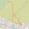
101 Trail and Fire Road
United States > California > Ventura County > San Buenaventura (Ventura)
Distance: 8.4 Km • Elevation gain: 405 m • Maximum elevation: 344 m
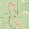
Solstice Canyon Loop
United States > California > Los Angeles County > Malibu
The Solstice Canyon Loop begins near the canyon entrance and climbs onto the sun-exposed Rising Sun Trail, where chaparral, coastal sage scrub, and open hillsides quickly replace the shaded canyon floor, revealing widening views across the folds of the Santa Monica Mountains and toward the Malibu coast. As the…
Distance: 4.8 Km • Elevation gain: 245 m • Maximum elevation: 228 m
Hunstanton to Kings Lynn
United Kingdom > England > Norfolk > King's Lynn and West Norfolk > Hunstanton
Norfolk Coast Path/England Coast Path
Distance: 31.2 Km • Elevation gain: 90 m • Maximum elevation: 25 m

Terrace Bay - Marathon
Canada > Ontario > Thunder Bay District > Terrace Bay Township
Lake Superior. #Bike #TerraceBay #Marathon #LakeSuperior
Distance: 83.0 Km • Elevation gain: 1,081 m • Maximum elevation: 322 m

Palmerston Escarpment Trail
Distance: 3.5 Km • Elevation gain: 34 m • Maximum elevation: 50 m

Terrace - Kitwanga
Canada > British Columbia > Regional District of Kitimat-Stikine > Terrace
Skeena River. #Bike
Distance: 96.5 Km • Elevation gain: 995 m • Maximum elevation: 231 m

Halle Ravine Nature Preserve and Pine Terrace Preserve loop trails
United States > New York > Westchester County > Town of Pound Ridge > Scotts Corners
Distance: 2.9 Km • Elevation gain: 69 m • Maximum elevation: 171 m

Loop Walk in Chatelherault Park
United Kingdom > Scotland > South Lanarkshire > Allanton
Distance: 5.0 Km • Elevation gain: 70 m • Maximum elevation: 84 m

Mount Rushmore Presidential Trail
United States > South Dakota > Pennington County
This loop trail is a delightful way to get up close and personal with the iconic monument. As you stroll along the paved path, you can admire the stunning views of the presidential faces from various angles and read interesting historical tidbits about each leader. While the stairs can be a bit of a workout,…
Distance: 1.0 Km • Elevation gain: 45 m • Maximum elevation: 1,617 m
Adelaide River - Robin Falls
Australia > Coomalie Shire > Adelaide River > Amangal
Distance: 19.4 Km • Elevation gain: 371 m • Maximum elevation: 215 m


Ride in Ventura Hills preserve
United States > California > Ventura County > San Buenaventura (Ventura)
Distance: 16.7 Km • Elevation gain: 613 m • Maximum elevation: 354 m

Upper Terrace Trails
Canada > Ontario > Renfrew County > Petawawa
Distance: 2.9 Km • Elevation gain: 23 m • Maximum elevation: 155 m

Walk along the coast and beach between Borth-y-Gêst and Morfa Bychan
United Kingdom > Wales > Gwynedd > Borth-y-Gêst
Distance: 4.2 Km • Elevation gain: 68 m • Maximum elevation: 32 m


Brighton - Adelaide
Australia > South Australia > Adelaide
#Bike
Distance: 23.4 Km • Elevation gain: 101 m • Maximum elevation: 53 m

Loop hike via Pittock Acres Park, Wilwood Trail, Hoyt Arboretum, Magnolia Trail, Washington Park and Japanes Garden Trail
United States > Oregon > Multnomah County > Portland
Distance: 6.6 Km • Elevation gain: 188 m • Maximum elevation: 250 m

Palisades Shore Trail and Long Trail loop
United States > New Jersey > Bergen County > Fort Lee > Coytesville
Distance: 6.3 Km • Elevation gain: 209 m • Maximum elevation: 109 m

Pencoed - Brynna Woods - Llanharan - Llantrisant Forest - Talbot Green - Pontyclun
United Kingdom > Wales > Bridgend County Borough > Pencoed
Lunch Walk
Distance: 15.9 Km • Elevation gain: 328 m • Maximum elevation: 258 m

Bike ride around Coalsnaughton via Tillicoultry, Alloa and Gartmorn Dam
United Kingdom > Scotland > Clackmannanshire > Coalsnaughton
Distance: 18.2 Km • Elevation gain: 171 m • Maximum elevation: 102 m


Winchcombe Cheltenham loop trailrun
United Kingdom > England > Gloucestershire > Winchcombe
Distance: 26.2 Km • Elevation gain: 594 m • Maximum elevation: 327 m
Silent Valley Nature Reserve loop trail
United Kingdom > Wales > Blaenau Gwent > Cwm
Distance: 2.5 Km • Elevation gain: 97 m • Maximum elevation: 356 m

Dandenong Ranges National Park Ridgewalk
Australia > Victoria > Melbourne > Tremont
Distance: 22.1 Km • Elevation gain: 1,002 m • Maximum elevation: 591 m

Part 1: Augusta to Cape 7.1 m
Australia > Western Australia > Augusta
Distance: 11.4 Km • Elevation gain: 136 m • Maximum elevation: 41 m

Cambridge - Providence Express
United States > Massachusetts > Middlesex County > Cambridge
Alewife -> Providence
Distance: 101.8 Km • Elevation gain: 961 m • Maximum elevation: 107 m
Parc Cwm Darran
United Kingdom > Wales > Caerphilly County Borough > Tir-Phil > Pentwyn
Cwm Darran trails
Distance: 4.1 Km • Elevation gain: 100 m • Maximum elevation: 322 m

Macleay Island Loop
Distance: 18.3 Km • Elevation gain: 201 m • Maximum elevation: 29 m

Rapaki Track via MTB Singletrack
New Zealand > Canterbury > Christchurch City > Christchurch
Distance: 13.1 Km • Elevation gain: 400 m • Maximum elevation: 332 m

Craig Y Llyn loop
United Kingdom > Wales > Rhondda Cynon Taf > Treherbert
Lunch Walk
Distance: 17.0 Km • Elevation gain: 522 m • Maximum elevation: 603 m
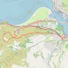
Mynydd y Dref Loop
United Kingdom > Wales > Conwy > Conwy > Conwy Marina Village
Distance: 9.9 Km • Elevation gain: 325 m • Maximum elevation: 240 m

Gravel ride around Prospect Hill
United States > Massachusetts > Essex County > Ipswich
Distance: 23.3 Km • Elevation gain: 306 m • Maximum elevation: 81 m

College Woods MTB Trails
United States > Virginia > James City County
Distance: 19.9 Km • Elevation gain: 132 m • Maximum elevation: 41 m
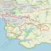
Plymouth eBike ride
United Kingdom > England > Plymouth
Distance: 43.3 Km • Elevation gain: 798 m • Maximum elevation: 116 m

Portreath Walk
United Kingdom > England > Cornwall > Portreath
Distance: 6.6 Km • Elevation gain: 176 m • Maximum elevation: 85 m

Cheesequake State Park
United States > New Jersey > Middlesex County > Old Bridge Township
Distance: 5.2 Km • Elevation gain: 48 m • Maximum elevation: 21 m
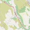
Cwm Darren
United Kingdom > Wales > Caerphilly County Borough > Deri
Distance: 8.0 Km • Elevation gain: 100 m • Maximum elevation: 296 m

River Tees Kayak
United Kingdom > England > County Durham > Barnard Castle
Distance: 12.3 Km • Elevation gain: 163 m • Maximum elevation: 138 m
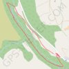
Cwm Darran bottom
United Kingdom > Wales > Caerphilly County Borough > Deri
Distance: 2.3 Km • Elevation gain: 38 m • Maximum elevation: 228 m

Lake Forest Sports Park
United States > California > Orange County > Lake Forest
Distance: 1.2 Km • Elevation gain: 24 m • Maximum elevation: 252 m
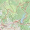
光板田坑 小丑坑 王母石澗 石頭峴坑左源 針城石澗
China > Hong Kong > Tsuen Wan District > Muk Min Ha Tsuen > Hoi Pa Village South Terrace
Hong Kong Hike
Distance: 25.9 Km • Elevation gain: 1,422 m • Maximum elevation: 602 m

馬鞍山(富安花園起步)
China > Hong Kong > Sha Tin District > Tai Shui Hang Village
Distance: 7.7 Km • Elevation gain: 397 m • Maximum elevation: 295 m

Jardine's Lookout
China > Hong Kong > Hong Kong Island
Distance: 6.1 Km • Elevation gain: 350 m • Maximum elevation: 410 m

馬鞍山(和君君家)
China > Hong Kong > Sha Tin District > Wu Kai Sha Village
Distance: 12.7 Km • Elevation gain: 754 m • Maximum elevation: 657 m