Import a GPX file

The Subway Trail

Zion National Park. Left Fork North Creek. Keyhole Falls, Archangel Falls. #Hiking #River #Waterfall #Canyon #Forest #Mountain #Nature #Zion

  • Distance: 11.5 Km
  • Elevation gain: 678 m
  • Maximum elevation: 1,759 m
  • Elevation loss: 678 m
  • Minimum elevation: 1,432 m

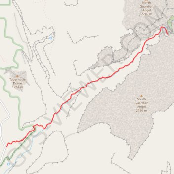
Interactive trail map

Trail profile

  • Distance: 11.5 Km
  • Elevation gain: 678 m
  • Maximum elevation: 1,759 m
  • Elevation loss: 678 m
  • Minimum elevation: 1,432 m

About this trail

Gear up for your next adventure:

🚲Handlebar Phone Mount - View topographic-map.com live while cycling
🚲MTB Frame Bag - Carry tools and maps directly on your bicycle frame
🛶Waterproof Dry Bags - Keep electronics and clothes dry during river crossings
🧢Hiking Hat - Sun-protective and breathable hats for long treks
🛏️Sleeping Bag - Warm and compact sleeping bags for outdoor camping

As an Amazon Associate, this site earns from qualifying purchases at no extra cost to you.