Import a GPX file

Bridge to Nowhere trails

Click on a trail to view its statistics, map and profile.
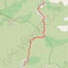
Bridge to Nowhere

United States > California > Los Angeles County

From Bridge to Nowhere Trailhead near Coyote Flat, the route enters Sheep Mountain Wilderness on the East Fork Trail and follows the East Fork of the San Gabriel River into a steep San Gabriel Mountains canyon of chaparral slopes, gravel bars and bouldery riverbank. The path continues upstream along the rocky…

Distance: 15.3 Km • Elevation gain: 544 m • Maximum elevation: 864 m
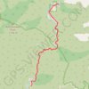
Bridge to Nowhere

United States > California > Los Angeles County

Hike to Bridge to Nowhere via East Fork Trail along the East Fork San Gabriel River in the Angeles National Forest and the Sheep Mountain Wilderness. #Hiking #River #Nature #Mountain #Forest #Angeles

Distance: 7.8 Km • Elevation gain: 421 m • Maximum elevation: 864 m

Return from Bridge to Nowhere

United States > California > Los Angeles County

Distance: 7.8 Km • Elevation gain: 222 m • Maximum elevation: 875 m
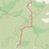
Bridge to Nowhere

United States > California > Los Angeles County

Distance: 15.4 Km • Elevation gain: 563 m • Maximum elevation: 864 m

Gear up for your next adventure:

🧦Hiking Socks - Moisture-wicking and comfortable socks for long hikes
🥾All-Terrain Hiking Boots - Versatile boots for varied hiking conditions
🕶️Polarized Sunglasses - Reduces glare from snow and water at high elevations
🛏️Sleeping Bag - Warm and compact sleeping bags for outdoor camping
👖Convertible Hiking Pants - Zip-off legs to adapt to changing weather conditions

As an Amazon Associate, this site earns from qualifying purchases at no extra cost to you.