Import a GPX file

Hararit

#Bike #Loop

  • Distance: 99.5 Km
  • Elevation gain: 1,683 m
  • Maximum elevation: 518 m
  • Elevation loss: 1,681 m
  • Minimum elevation: 56 m

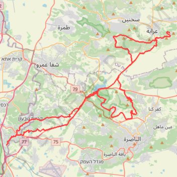
Interactive trail map

Trail profile

  • Distance: 99.5 Km
  • Elevation gain: 1,683 m
  • Maximum elevation: 518 m
  • Elevation loss: 1,681 m
  • Minimum elevation: 56 m

About this trail

Other hiking, mountain biking, running and outdoor activity trails

Click on a trail to view its statistics, map and profile.

Har Turan

Israel > North District > Al Batuf Regional Council

Loop running from Rumana. #Running #Loop #Mountain #Nature #Forest #Countryside

Distance: 26.9 Km • Elevation gain: 652 m • Maximum elevation: 542 m

סיבוב בעמק יזרעאל

Israel > North District > Emek Izrael Regional Council > Beit Zaid

Distance: 45.8 Km • Elevation gain: 414 m • Maximum elevation: 186 m

Home78Rec

Israel > Haifa District > Nesher

Distance: 78.4 Km • Elevation gain: 1,479 m • Maximum elevation: 461 m

Gear up for your next adventure:

🥾Lightweight Hiking Shoes - Comfortable shoes for day hikes
🥾Durable Hiking Shoes - Long-lasting shoes for frequent hiking
🥾Hiking Shorts - Breathable shorts suitable for summer hikes
🔨Vehicle Emergency Tool - Safety tool for remote road trips to trailheads
🎒Hiking Daypack - Lightweight and durable backpacks for day trips and excursions

As an Amazon Associate, this site earns from qualifying purchases at no extra cost to you.