Import a GPX file

Nesher trails

Click on a trail to view its statistics, map and profile.
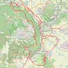
Home78Rec

Israel > Haifa District > Nesher

Distance: 78.4 Km • Elevation gain: 1,479 m • Maximum elevation: 461 m
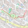
פארק שמואל

Israel > Haifa District > Nesher

Distance: 1.3 Km • Elevation gain: 44 m • Maximum elevation: 127 m

Gear up for your next adventure:

🚲Handlebar Phone Mount - View topographic-map.com live while cycling
⛺Tent Footprint - Protect tent floor and increase durability
🧦Outdoor Socks - Durable socks designed for hiking and outdoor sports
🧊Insulated Water Bottle - Keeps drinks cold in summer and prevents freezing in winter
🧳Compression Sacks - Maximize space in your backpack by shrinking gear

As an Amazon Associate, this site earns from qualifying purchases at no extra cost to you.