
Reco Mountain trails
Click on a trail to view its statistics, map and profile.

Skyline Trail Loop in Beavers Bend State Park
United States > Oklahoma > McCurtain County
The Skyline Trail is a challenging loop hike that rewards adventurous visitors with sweeping views of the surrounding Ouachita Mountains, lush forests, glimpses of the Mountain Fork River below and even a hidden waterfall nestled in the forest. The trail leads hikers through rocky paths, forested ridges, and…
Distance: 13.7 Km • Elevation gain: 450 m • Maximum elevation: 263 m

Chain Lakes Loop Trail
United States > Washington > Whatcom County
The Chain Lakes Loop Trail explores the dramatic alpine landscape of the Mount Baker–Snoqualmie National Forest, beginning here at Artist Point beneath the steep southern slopes of Table Mountain. The trail initially traverses open heather meadows and rocky terrain, with broad views toward Mount Baker, Mount…
Distance: 9.1 Km • Elevation gain: 601 m • Maximum elevation: 1,668 m
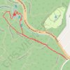
Hemlock Falls Loop
United States > New Jersey > Essex County > Maplewood
Starting from the South Orange Avenue access, this loop enters South Mountain Reservation on the Crest Trail and follows a shaded woodland corridor before joining Openwood Trail and curving deeper into the forest. The route then uses Lenape Trail and the local Hemlock Falls Loop to reach Hemlock Falls on…
Distance: 2.6 Km • Elevation gain: 67 m • Maximum elevation: 163 m
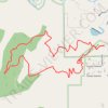
Turkey Trot Trail Loop via Castle Trail in Mount Falcon Park
United States > Colorado > Jefferson County > Morrison
From the Morrison Trailhead, the route starts on Castle Trail, leaving the edge of town for open foothill slopes, switchbacks and early views toward Red Rocks and the Denver skyline. It then joins Turkey Trot Trail, a hiker-focused section that climbs and contours through quieter pine, scrub and rocky hillside…
Distance: 5.4 Km • Elevation gain: 280 m • Maximum elevation: 2,069 m
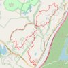
Wildcat Mountain and Indian Hill Loop
United States > New York > Orange County > Town of Tuxedo
Starting at the Tuxedo Park and Ride above the Ramapo Valley, the route climbs out of Southfields on the Wildcat Mountain Trail, passes the wooded shoulder of Wildcat Mountain, and threads a quiet ridge corridor between Harriman State Park and Sterling Forest State Park before bending toward Townsend Trail and…
Distance: 20.1 Km • Elevation gain: 736 m • Maximum elevation: 327 m

Middle Sister and Mount Chocorua Loop
United States > New Hampshire > Carroll County > Albany
From the Piper Trailhead in White Mountain National Forest, this loop follows Piper Trail into the forest, turns onto Nickerson Ledge Trail, and climbs toward Carter Ledge, a quieter ridge route known for open ledges, views of Mount Chocorua, and the Three Sisters. The itinerary continues over the Three…
Distance: 13.2 Km • Elevation gain: 824 m • Maximum elevation: 1,049 m
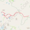
Big Pine Lakes Loop
United States > California > Inyo County
From the Glacier Lodge area, this Big Pine Lakes Loop begins along the North Fork Big Pine Creek Trail, entering the John Muir Wilderness of Inyo National Forest. The route climbs beside North Fork Big Pine Creek through forest and sagebrush slopes before reaching the higher canyon beneath Mount Alice. The…
Distance: 24.5 Km • Elevation gain: 1,235 m • Maximum elevation: 3,432 m

Precipice Loop via Champlain Mountain in Acadia National Park
United States > Maine > Hancock County > Bar Harbor
The Precipice Loop is a highly challenging and adventurous hike, renowned for its steep, exposed cliffs and iron rungs that assist hikers in ascending the vertical face of Champlain Mountain. The climb offers dramatic views of Frenchman Bay and the surrounding landscapes, but it demands both physical stamina…
Distance: 4.5 Km • Elevation gain: 359 m • Maximum elevation: 317 m
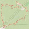
Mount Lukens Loop from Deukmejian Wilderness Park
United States > California > Los Angeles County > Glendale
Starting at Mount Lukens Trailhead in Deukmejian Wilderness Park, the route first leaves the Stone Barn area, crosses Dunsmore Creek on the lower park connector, and joins Crescenta View Trail before climbing through chaparral and sage scrub above Dunsmore Canyon toward The Redoubt. The ascent continues over…
Distance: 15.9 Km • Elevation gain: 1,065 m • Maximum elevation: 1,537 m

Mount Islip via Pacific Crest Trail / Silver Moccasin Trail and Mount Islip Trail
United States > California > Los Angeles County
Hiking Mount Islip offers a well-rounded experience in the San Gabriel Mountains. Along the route, you'll encounter diverse landscapes, including dense forests, scenic ridgelines, and expansive views stretching from the Mojave Desert to the surrounding San Gabriel Canyon, with glimpses of the rugged ridges and…
Distance: 8.8 Km • Elevation gain: 743 m • Maximum elevation: 2,506 m

Reco Mountain
Canada > British Columbia > Regional District of Central Kootenay > Area D (Lardeau Valley/Duncan Lake)
Distance: 35.9 Km • Elevation gain: 2,231 m • Maximum elevation: 2,315 m