El Moro Canyon Loop
Loop hike via Moro Canyon Trail and Moro Ridge Spur in Crystal Cove State Park #Hiking #Loop #Canyon #Ocean
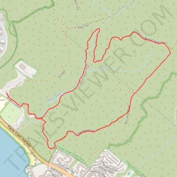
- Distance: 7.8 Km
- Elevation gain: 243 m
- Maximum elevation: 223 m
- Elevation loss: 243 m
- Minimum elevation: 14 m
- Moving time: 1 h 50 m
- Moving speed: 4.2 Km/h
- Maximum speed: 5.9 Km/h
- Total time: 1 h 53 m
- Global speed: 4.1 Km/h
Interactive trail map
Trail profile
- Distance: 7.8 Km
- Elevation gain: 243 m
- Maximum elevation: 223 m
- Elevation loss: 243 m
- Minimum elevation: 14 m
- Moving time: 1 h 50 m
- Moving speed: 4.2 Km/h
- Maximum speed: 5.9 Km/h
- Total time: 1 h 53 m
- Global speed: 4.1 Km/h
About this trail
Name: El Moro Canyon Loop trail, distance, elevation, map, profile, GPS track
Start: El Moro Canyon, Orange County, California, 92667, United States (33.56545 -117.82285)
End: El Moro Canyon, Orange County, California, 92667, United States (33.56543 -117.82284)
Coordinates: 33.55872 -117.82285 33.57319 -117.79919
Other hiking, mountain biking, running and outdoor activity trails
Click on a trail to view its statistics, map and profile.
Crystal Cove State Park
United States > California > Orange County > Newport Beach
Crystal Cove State Park’s loop starts near the El Moro coastal entrance, crosses into Moro Canyon, and follows a sheltered inland corridor shaped by seasonal Moro Creek, riparian woodland, coastal sage scrub, and the rugged slopes of the San Joaquin Hills. The hike then climbs toward the higher backcountry…
Distance: 14.4 Km • Elevation gain: 397 m • Maximum elevation: 314 m
El Moro Canyon Loop Trail in Crystal Cove State Park
United States > California > Orange County
The El Moro Canyon Loop Trail in Crystal Cove State Park offers a rewarding journey through diverse terrains, including canyons, rolling hills and ridgelines. Along the path, hikers will encounter expansive vistas of the Pacific Ocean, with views extending to Newport Beach to the north and Laguna Beach to the…
Distance: 8.0 Km • Elevation gain: 248 m • Maximum elevation: 222 m