
Slide Mountain trails
Click on a trail to view its statistics, map and profile.
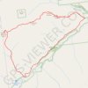
Big Slide Mountain Loop
United States > New York > Essex County > Town of Keene
Lop hike from Garden Parking to Big Slide Mountain via Phelps Trail, Big Slide Trail, The Brothers Trail, Third Brother, Second Brother and First Brother in the High Peaks Wilderness. #Hiking #Loop #Mountain #Nature #Wilderness
Distance: 14.5 Km • Elevation gain: 855 m • Maximum elevation: 1,252 m
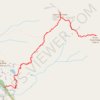
Giant Mountain and Rocky Peak Ridge
United States > New York > Essex County > Town of Keene
Starting from Chapel Pond, the route climbs the Ridge Trail through forest and exposed rock to Ridge Lookout, with early views over Chapel Pond, then reaches Giant Washbowl before linking toward the Roaring Brook Trail junction. The ascent continues over steep open slabs and long ridge sections to Giant…
Distance: 13.1 Km • Elevation gain: 1,336 m • Maximum elevation: 1,387 m

Ernie Maxwell Scenic Trail
United States > California > Riverside County > Idyllwild
Starting from the Idyllwild side near Tahquitz View Drive, the Ernie Maxwell Scenic Trail climbs gently through shaded pine, oak, cedar and manzanita forest on the lower slopes of the San Jacinto Mountains. The route passes granite boulders and seasonal drainages before opening occasional views across…
Distance: 3.8 Km • Elevation gain: 285 m • Maximum elevation: 1,966 m
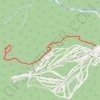
Mount Tecumseh Trail in White Mountain National Forest
United States > New Hampshire > Grafton County > Waterville Valley
The Mount Tecumseh Trail offers a scenic yet challenging route through dense woodlands, with distinct shifts in landscape as hikers ascend. Starting with a gentle, moss-covered forest floor and occasional streams, the trail becomes steeper as it winds through fir and spruce trees, offering occasional glimpses…
Distance: 7.7 Km • Elevation gain: 660 m • Maximum elevation: 1,197 m
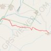
Slide Mountain
United States > New York > Ulster County > Town of Shandaken
Hike from West Branch Neversink River to Slide Mountain via Phoenicia - East Branch Trail, Wittenberg - Cornell - Slide Trail and John Burroughs Monument in the Slide Mountain Wilderness and the Cattskill Park. #Hiking #Mountain #Nature #Forest #Wilderness #Park
Distance: 8.6 Km • Elevation gain: 526 m • Maximum elevation: 1,263 m
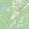
Great Escape, Rabbit's Foot, Shady Past, Old Canoe, Sulphur Slide and Creek 2 Peak loop trails
Canada > Alberta > Municipal District of Greenview > Hamlet of Grande Cache
Afternoon Mountain Bike Ride
Distance: 10.0 Km • Elevation gain: 214 m • Maximum elevation: 1,220 m
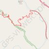
Slide Mountain
United States > California > Los Angeles County
Hike to Slide Mountain via abandoned Golden State Highway and Slide Mountain Trail in Angeles National Forest, Los Padres National Forest and Sespe Wilderness. #Hiking #Mountain #Nature #Forest #Wilderness
Distance: 8.7 Km • Elevation gain: 826 m • Maximum elevation: 1,395 m
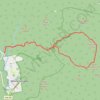
Tripyramid Mountains Loop
United States > New Hampshire > Grafton County > Waterville Valley
Loop hike from Livermore South Trailhead to North Tripyramid, Middle Tripyramid and South Tripyramid via Livermore Road, Avalanche Brook, Mount Tripyramid Trail and Slide Brook in the Sandwich Range Wilderness. #Hiking #Loop #Mountain #Forest #Nature #Wilderness
Distance: 17.1 Km • Elevation gain: 854 m • Maximum elevation: 1,246 m