Import a GPX file

Houston trails

Click on a trail to view its statistics, map and profile.
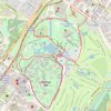
Hermann Park Loop Walking

United States > Texas > Harris County > Houston

Distance: 5.6 Km • Elevation gain: 12 m • Maximum elevation: 21 m
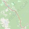
Smithers - Houston

Canada > British Columbia > Regional District of Bulkley-Nechako > Smithers

#Bike #Smithers #Houston

Distance: 65.6 Km • Elevation gain: 642 m • Maximum elevation: 842 m

Houston - Burns Lake

Canada > British Columbia > Regional District of Bulkley-Nechako > Houston

#Bike #Houston #Burns

Distance: 79.6 Km • Elevation gain: 760 m • Maximum elevation: 878 m

Palisades Park loop walk

United States > Washington > Spokane County

Distance: 2.2 Km • Elevation gain: 38 m • Maximum elevation: 683 m
Steelhead Park

Canada > British Columbia > Regional District of Bulkley-Nechako > Houston

Distance: 0.6 Km • Elevation gain: 2 m • Maximum elevation: 596 m

Gear up for your next adventure:

🥾Mountaineering Boots - Supportive boots for climbing and high-altitude hiking
🧤Insulated Winter Gloves - Heavy-duty protection for sub-zero Canadian adventures
🚲Handlebar Phone Mount - View topographic-map.com live while cycling
⛺Camping Groundsheet - Protect your tent from moisture and dirt
📷Outdoor Action Camera - Capture high-elevation views and rugged adventures

As an Amazon Associate, this site earns from qualifying purchases at no extra cost to you.