Import a GPX file

Smithers trails

Click on a trail to view its statistics, map and profile.

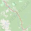
Smithers - Houston

Canada > British Columbia > Regional District of Bulkley-Nechako > Smithers

#Bike #Smithers #Houston

Distance: 65.6 Km • Elevation gain: 642 m • Maximum elevation: 842 m

Gear up for your next adventure:

💧Reusable Water Bottle - Durable water bottles for hydration on trails
🥾Mountain Hiking Boots - High-traction boots for rocky terrain
🥾Mountain Hiking Shoes - Shoes with superior grip for mountainous terrain
🚲Handlebar Phone Mount - View topographic-map.com live while cycling
🌡️Emergency Mylar Blankets - Compact thermal protection for unexpected nights outdoors

As an Amazon Associate, this site earns from qualifying purchases at no extra cost to you.