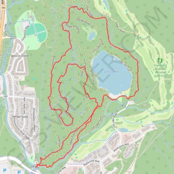
Lost Lake - Whistler
Interactive trail map
Trail profile
- Distance: 7.5 Km
- Elevation gain: 177 m
- Maximum elevation: 737 m
- Elevation loss: 177 m
- Minimum elevation: 664 m
About this trail
Name: Lost Lake - Whistler trail, distance, elevation, map, profile, GPS track
Coordinates: 50.11982 -122.94840 50.13498 -122.93329
Topography: Squamish-Lillooet Regional District topographic map, elevation, terrain
Other hiking, mountain biking, running and outdoor activity trails
Click on a trail to view its statistics, map and profile.