Import a GPX file

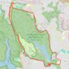
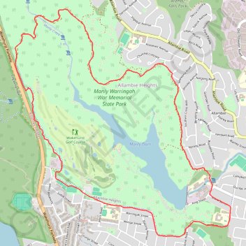
Manly Dam Loop

#Hiking #MTB #Loop

  • Distance: 9.3 Km
  • Elevation gain: 190 m
  • Maximum elevation: 123 m
  • Elevation loss: 190 m
  • Minimum elevation: 20 m

Interactive trail map

Trail profile

  • Distance: 9.3 Km
  • Elevation gain: 190 m
  • Maximum elevation: 123 m
  • Elevation loss: 190 m
  • Minimum elevation: 20 m

About this trail
Other hiking, mountain biking, running and outdoor activity trails

Click on a trail to view its statistics, map and profile.
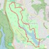
Manly Dam

Australia > New South Wales > Sydney

#Hiking #Loop

Distance: 9.1 Km • Elevation gain: 198 m • Maximum elevation: 125 m

Manly Dam MTB Loop Trail

Australia > New South Wales > Sydney

Distance: 13.2 Km • Elevation gain: 188 m • Maximum elevation: 148 m

Gear up for your next adventure:

⛺Family Camping Tent - Spacious tent suitable for family camping trips
🧼Travel Hand Sanitizer - Keep hands clean when water is scarce
🧴Waterproofing Spray - Restore the DWR coating on jackets and tents
🥾Light Hiking Boots - Lightweight and comfortable boots for day hikes
🥽Outdoor Goggles - Protective eyewear for outdoor activities

As an Amazon Associate, this site earns from qualifying purchases at no extra cost to you.