Ernie's Trail and Honeymoon Trail
- Distance: 4.4 Km
- Elevation gain: 70 m
- Maximum elevation: 342 m
- Elevation loss: 70 m
- Minimum elevation: 323 m
- Moving time: 1 h 15 m
- Moving speed: 3.5 Km/h
- Maximum speed: 11.4 Km/h
- Total time: 1 h 58 m
- Global speed: 2.2 Km/h
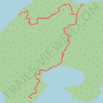
Interactive trail map
Trail profile
- Distance: 4.4 Km
- Elevation gain: 70 m
- Maximum elevation: 342 m
- Elevation loss: 70 m
- Minimum elevation: 323 m
- Moving time: 1 h 15 m
- Moving speed: 3.5 Km/h
- Maximum speed: 11.4 Km/h
- Total time: 1 h 58 m
- Global speed: 2.2 Km/h
About this trail
Name: Ernie's Trail and Honeymoon Trail trail, distance, elevation, map, profile, GPS track
Coordinates: 49.69292 -94.72311 49.70054 -94.71507
Topography: Unorganized Kenora District topographic map, elevation, terrain
Other hiking, mountain biking, running and outdoor activity trails
Click on a trail to view its statistics, map and profile.
Whiteshell - Kenora
Canada > Unorganized Division No. 1
#Bike #Whiteshell #Kenora
Distance: 69.2 Km • Elevation gain: 577 m • Maximum elevation: 382 m