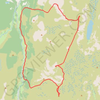
Munro hillwalk Sgor Gaoith Mullach Clach a' Bhlair
- Distance: 30.1 Km
- Elevation gain: 1,157 m
- Maximum elevation: 1,108 m
- Elevation loss: 1,158 m
- Minimum elevation: 285 m
- Moving time: 7 h 16 m
- Moving speed: 4.1 Km/h
- Maximum speed: 23.6 Km/h
- Total time: 8 h 2 m
- Global speed: 3.7 Km/h
Interactive trail map
Trail profile
- Distance: 30.1 Km
- Elevation gain: 1,157 m
- Maximum elevation: 1,108 m
- Elevation loss: 1,158 m
- Minimum elevation: 285 m
- Moving time: 7 h 16 m
- Moving speed: 4.1 Km/h
- Maximum speed: 23.6 Km/h
- Total time: 8 h 2 m
- Global speed: 3.7 Km/h
About this trail
Name: Munro hillwalk Sgor Gaoith Mullach Clach a' Bhlair trail, distance, elevation, map, profile, GPS track
Start: Achlean Road, Highland, Scotland, PH21 1NH, United Kingdom (57.08770 -3.89497)
End: Achlean Road, Highland, Scotland, PH21 1NH, United Kingdom (57.08782 -3.89497)
Coordinates: 57.01164 -3.90231 57.09121 -3.80788
Other hiking, mountain biking, running and outdoor activity trails
Click on a trail to view its statistics, map and profile.
Cairngorms hike
United Kingdom > Scotland > Highland > Aviemore
Distance: 80.8 Km • Elevation gain: 3,001 m • Maximum elevation: 1,312 m