Los Leones Trail and East Topanga Fire Road in Topanga State Park
The Los Leones Trail and East Topanga Fire Road offer an excellent opportunity to experience the diverse beauty of Topanga State Park. Starting from the lush and shaded Los Leones Canyon, hikers are treated to a variety of vegetation, from coastal sage scrub to oak woodlands, with stunning vistas of the Pacific Ocean and Malibu's coastline becoming more expansive as you ascend. The East Topanga Fire Road, known for its wide, open stretches, provides a contrast with sweeping views of the Santa Monica Mountains, including dramatic panoramas that stretch across the city and beyond. Overall, this combination of rugged terrain, forested trails, and breathtaking views makes for a rewarding hike. #Hiking #Coast #Forest #Nature #Overlook #Sea #Pacific #Ocean
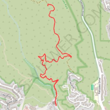
- Distance: 6.8 Km
- Elevation gain: 369 m
- Maximum elevation: 386 m
- Elevation loss: 368 m
- Minimum elevation: 78 m
- Moving time: 1 h 49 m
- Moving speed: 3.7 Km/h
- Maximum speed: 6.3 Km/h
- Total time: 2 h 18 m
- Global speed: 2.9 Km/h
Interactive trail map
Trail profile
- Distance: 6.8 Km
- Elevation gain: 369 m
- Maximum elevation: 386 m
- Elevation loss: 368 m
- Minimum elevation: 78 m
- Moving time: 1 h 49 m
- Moving speed: 3.7 Km/h
- Maximum speed: 6.3 Km/h
- Total time: 2 h 18 m
- Global speed: 2.9 Km/h
About this trail
Name: Los Leones Trail and East Topanga Fire Road in Topanga State Park trail, distance, elevation, map, profile, GPS track
Coordinates: 34.04630 -118.56305 34.06050 -118.55739
Other hiking, mountain biking, running and outdoor activity trails
Click on a trail to view its statistics, map and profile.