
Oct 5, 2026 14:23:01
- Distance: 48.0 Km
- Elevation gain: 171 m
- Maximum elevation: 599 m
- Elevation loss: 140 m
- Minimum elevation: 520 m
Interactive trail map
Trail profile
- Distance: 48.0 Km
- Elevation gain: 171 m
- Maximum elevation: 599 m
- Elevation loss: 140 m
- Minimum elevation: 520 m
About this trail
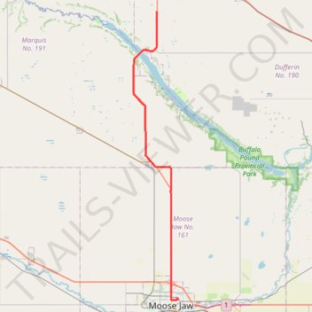
Name: Oct 5, 2026 14:23:01 trail, distance, elevation, map, profile, GPS track
Start: 5th Avenue Northeast, Hillcrest, Moose Jaw, Saskatchewan, S6H 6Y7, Canada (50.40360 -105.52166)
End: Highway 2, Dufferin No. 190, Saskatchewan, Canada (50.76923 -105.56309)
Coordinates: 50.40262 -105.60929 50.76923 -105.52035
Topography: Moose Jaw topographic map, elevation, terrain
Other hiking, mountain biking, running and outdoor activity trails
Click on a trail to view its statistics, map and profile.
