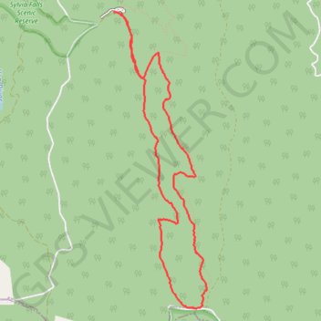
Tanglefoot Loop
Interactive trail map
Trail profile
- Distance: 8.9 Km
- Elevation gain: 338 m
- Maximum elevation: 925 m
- Elevation loss: 349 m
- Minimum elevation: 629 m
- Moving time: 1 h 58 m
- Moving speed: 4.5 Km/h
- Maximum speed: 15.2 Km/h
- Total time: 2 h 3 m
- Global speed: 4.3 Km/h
About this trail
Name: Tanglefoot Loop trail, distance, elevation, map, profile, GPS track
Start: Tanglefoot Loop, Toolangi, Shire of Murrindindi, Victoria, 3777, Australia (-37.52776 145.52202)
End: Wirrawilla Road, Toolangi, Shire of Murrindindi, Victoria, 3777, Australia (-37.52752 145.52124)
Coordinates: -37.55688 145.52124 -37.52750 145.53282
Other hiking, mountain biking, running and outdoor activity trails
Click on a trail to view its statistics, map and profile.
Tallarook - Eildon - Hurstbridge
Australia > Victoria > Tallarook
#Bike
Distance: 278.8 Km • Elevation gain: 4,897 m • Maximum elevation: 868 m
Tanglefoot Trails of Toolangi
Distance: 15.6 Km • Elevation gain: 580 m • Maximum elevation: 925 m