Escondido Falls
Interactive trail map
Trail profile
- Distance: 6.0 Km
- Elevation gain: 220 m
- Maximum elevation: 180 m
- Elevation loss: 220 m
- Minimum elevation: 42 m
About this trail
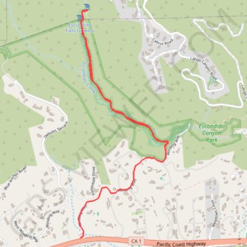
Name: Escondido Falls trail, distance, elevation, map, profile, GPS track
Coordinates: 34.02605 -118.78025 34.04298 -118.77221
Other hiking, mountain biking, running and outdoor activity trails
Click on a trail to view its statistics, map and profile.
Escondido Falls Trail in Escondido Canyon Park
United States > California > Los Angeles County > Malibu
The Escondido Falls Trail in Malibu offers hikers a journey through diverse landscapes, beginning with a paved path flanked by impressive hillside residences and ocean vistas. As the trail progresses into Escondido Canyon Park, adventurers are enveloped by a canopy of oak and sycamore trees, with the soothing…
Distance: 5.8 Km • Elevation gain: 164 m • Maximum elevation: 128 m