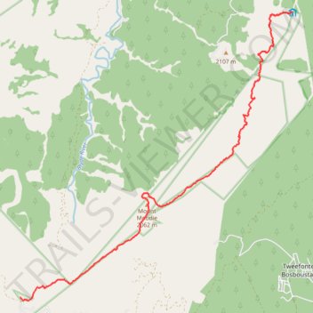
Fanie Botha Stables Hut to Mac Mac Hut via Mount Moodie
- Distance: 16.5 Km
- Elevation gain: 717 m
- Maximum elevation: 2,058 m
- Elevation loss: 904 m
- Minimum elevation: 1,538 m
- Moving time: 5 h 3 m
- Moving speed: 3.3 Km/h
- Maximum speed: 6.0 Km/h
- Total time: 7 h 19 m
- Global speed: 2.3 Km/h
Interactive trail map
Trail profile
- Distance: 16.5 Km
- Elevation gain: 717 m
- Maximum elevation: 2,058 m
- Elevation loss: 904 m
- Minimum elevation: 1,538 m
- Moving time: 5 h 3 m
- Moving speed: 3.3 Km/h
- Maximum speed: 6.0 Km/h
- Total time: 7 h 19 m
- Global speed: 2.3 Km/h
About this trail
Name: Fanie Botha Stables Hut to Mac Mac Hut via Mount Moodie trail, distance, elevation, map, profile, GPS track
Coordinates: -25.06329 30.70017 -24.98579 30.78063
Other hiking, mountain biking, running and outdoor activity trails
Click on a trail to view its statistics, map and profile.
Fanie Botha Maritzbos Hut to Stables Hut
South Africa > Mpumalanga > Ehlanzeni District Municipality > Thaba Chweu Local Municipality
Distance: 12.5 Km • Elevation gain: 891 m • Maximum elevation: 1,949 m
Fanie Botha Mac Mac Hut to Graskop Hut
South Africa > Mpumalanga > Ehlanzeni District Municipality > Thaba Chweu Local Municipality > Graskop
Distance: 12.6 Km • Elevation gain: 280 m • Maximum elevation: 1,635 m