Import a GPX file

Graskop trails

Click on a trail to view its statistics, map and profile.
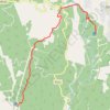
Fanie Botha Mac Mac Hut to Graskop Hut

South Africa > Mpumalanga > Ehlanzeni District Municipality > Thaba Chweu Local Municipality > Graskop

Distance: 12.6 Km • Elevation gain: 280 m • Maximum elevation: 1,635 m

Gear up for your next adventure:

🧤Insulated Winter Gloves - Heavy-duty protection for sub-zero Canadian adventures
🧭GPS Tracker - Track your location in remote areas safely
🚲Bike Repair Kit - Essential tools for on-trail mechanical issues
🧭GPS Outdoor Watch - Smart watch for navigation and fitness tracking in nature
🥾Lightweight Hiking Boots - Boots for comfort and mobility on long hikes

As an Amazon Associate, this site earns from qualifying purchases at no extra cost to you.