Thank you for supporting this site ❤️
Make a donation
Make a donation
Gear up for your next adventure:
As an Amazon Associate, this site earns from qualifying purchases at no extra cost to you.
Griffith Park
Morning Hike
- Distance: 5.6 Km
- Elevation gain: 231 m
- Maximum elevation: 325 m
- Elevation loss: 232 m
- Minimum elevation: 138 m
- Moving time: 1 h 14 m
- Moving speed: 4.5 Km/h
- Maximum speed: 7.2 Km/h
- Total time: 1 h 24 m
- Global speed: 4.0 Km/h
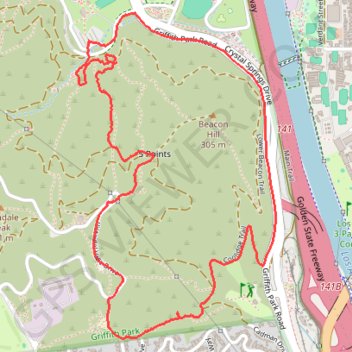
Interactive trail map
Thank you for supporting this site ❤️
Make a donation
Make a donation
Gear up for your next adventure:
As an Amazon Associate, this site earns from qualifying purchases at no extra cost to you.
Trail profile
- Distance: 5.6 Km
- Elevation gain: 231 m
- Maximum elevation: 325 m
- Elevation loss: 232 m
- Minimum elevation: 138 m
- Moving time: 1 h 14 m
- Moving speed: 4.5 Km/h
- Maximum speed: 7.2 Km/h
- Total time: 1 h 24 m
- Global speed: 4.0 Km/h
Thank you for supporting this site ❤️
Make a donation
Make a donation
Gear up for your next adventure:
As an Amazon Associate, this site earns from qualifying purchases at no extra cost to you.
About this trail
Name: Griffith Park trail, distance, elevation, map, profile, GPS track
Coordinates: 34.11926 -118.28417 34.13266 -118.27424
Thank you for supporting this site ❤️
Make a donation
Make a donation
Gear up for your next adventure:
As an Amazon Associate, this site earns from qualifying purchases at no extra cost to you.