
Dunn County trails
Click on a trail to view its statistics, map and profile.
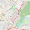
Dunn Creek Greenway
United States > North Carolina > Wake County
Distance: 13.2 Km • Elevation gain: 126 m • Maximum elevation: 127 m

Mount Tammany Loop via Red Dot Trail, Delaware River Overlook and Blue Blaze in Worthington State Forest
United States > New Jersey > Warren County > Hardwick Township > Dunnfield
The Mount Tammany Loop offers a captivating hiking experience with its stunning panoramic views of the Delaware River and the surrounding landscapes. The ascent via the Red Dot Trail features rocky terrain and steep inclines, rewarding hikers with scenic overlooks, particularly the dramatic vistas of Mount…
Distance: 5.6 Km • Elevation gain: 365 m • Maximum elevation: 458 m

Mount Tammany and Delaware River Overlook via Red Dot Trail in Worthington State Forest
United States > New Jersey > Warren County > Hardwick Township > Dunnfield
Hiking the Red Dot Trail offers an invigorating experience with stunning views of the Delaware River and the surrounding Kittatinny Mountains. As you ascend, you'll encounter rocky sections that provide rewarding overlooks, especially during the fall when the foliage is vibrant. This route not only highlights…
Distance: 4.1 Km • Elevation gain: 344 m • Maximum elevation: 437 m
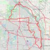
Park to Park Loop
United States > Minnesota > Hennepin County > Minneapolis
Loop bike via North Mississippi Park, Creekview Park, Shingle Creek Park, Centennial Park, Palmer Lake Park, Brookdale Park, Central Park, Noble Sports Park, Rush Creek Regional Trail, Oak Grove Park, Elm Creek Winter Recreation Area, Mud Lake, Goose Lake, Mississippi River, Akin Riverside Park, Riverview…
Distance: 67.5 Km • Elevation gain: 264 m • Maximum elevation: 284 m


Hoffman Hills Loop via Skyline, Starwars and Hawk Ridge
United States > Wisconsin > Dunn County
Distance: 5.7 Km • Elevation gain: 143 m • Maximum elevation: 376 m
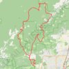
Trails and roads around Dunn Forest
United States > Oregon > Benton County
Distance: 43.6 Km • Elevation gain: 1,516 m • Maximum elevation: 571 m

Hoffman Hills Loop
United States > Wisconsin > Dunn County
Distance: 6.6 Km • Elevation gain: 107 m • Maximum elevation: 359 m