
Deep River trails
Click on a trail to view its statistics, map and profile.
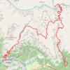
South Kaibab - Tonto - Bright Angel (Grand Canyon)
United States > Arizona > Coconino County
From Yaki Point, the route commits at once to the exposed descent of the South Kaibab Trail, a dramatic ridgeline path known for wide, open views and very little shade or water. It first reaches Ooh Aah Point, where the canyon opens suddenly in every direction, then continues through the sculpted upper…
Distance: 30.1 Km • Elevation gain: 2,293 m • Maximum elevation: 2,217 m
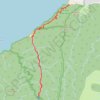
Hanakapi'ai Falls (Kauai Island)
United States > Hawaii > Kauaʻi County
Starting at Kēʻē Beach in Hāʻena State Park, this out-and-back hike follows the Kalalau Trail above the Pacific, leaving the coastal edge of the park to reveal the first broad views of the Nā Pali Coast, with ocean, reef, sea cliffs, and tropical vegetation appearing in succession along the way. The…
Distance: 12.8 Km • Elevation gain: 1,180 m • Maximum elevation: 409 m

Phantom Ranch via South Kaibab Trail, Skeleton Point, Bright Angel Trail and Indian Garden
United States > Arizona > Coconino County
From the South Kaibab Trailhead near Yaki Point, the route drops into the Grand Canyon on an open ridgeline, passing Ooh Aah Point, Cedar Ridge, Skeleton Point and The Tipoff, with broad views over the South Rim cliffs, the Tonto Platform and the deepening corridor of the Colorado River. It then descends…
Distance: 30.6 Km • Elevation gain: 2,650 m • Maximum elevation: 2,201 m

Santa Elena Canyon Trail in Big Bend National Park
United States > Texas > Brewster County
The Santa Elena Canyon Trail offers a short but scenic hike through some of the most impressive landscapes in the park. After crossing Terlingua Creek and ascending some steps, hikers are greeted by stunning views of towering limestone cliffs that rise high above the Rio Grande. The trail’s peaceful vibe,…
Distance: 2.9 Km • Elevation gain: 136 m • Maximum elevation: 759 m

Glacier Point and Union Point via Four Mile Trail
United States > California > Mariposa County > Yosemite Village > Yosemite Lodge
From Yosemite Valley, the Four Mile Trail climbs away from the Merced River through forested slopes and long switchbacks on the south wall of the valley, steadily opening views toward Sentinel Rock, El Capitan, Yosemite Falls, and the granite cliffs that frame the valley floor. Higher on the route, the path…
Distance: 15.2 Km • Elevation gain: 1,647 m • Maximum elevation: 2,197 m

Bluff Trail and Canyon Trail Loop in Matthiessen State Park
United States > Illinois > LaSalle County > Deer Park
The Bluff Trail and Canyon Trail Loop offers a captivating hiking experience through diverse landscapes. Hikers will encounter impressive rock formations, lush vegetation, and seasonal waterfalls that enhance the park's natural beauty. The trail features scenic overlooks with breathtaking views of the…
Distance: 3.8 Km • Elevation gain: 63 m • Maximum elevation: 193 m
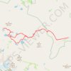
Big Pine Lakes Loop
United States > California > Inyo County
From the Glacier Lodge area, this Big Pine Lakes Loop begins along the North Fork Big Pine Creek Trail, entering the John Muir Wilderness of Inyo National Forest. The route climbs beside North Fork Big Pine Creek through forest and sagebrush slopes before reaching the higher canyon beneath Mount Alice. The…
Distance: 24.5 Km • Elevation gain: 1,235 m • Maximum elevation: 3,432 m
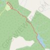
Avalanche Lake
United States > Montana > Flathead County
Starting from the Avalanche area, the route first follows the shaded Trail of the Cedars through old-growth cedar and hemlock forest beside Avalanche Creek, where the water has carved the narrow and lively passage of Avalanche Gorge. Beyond the gorge, the Avalanche Lake Trail leaves the boardwalk and climbs…
Distance: 9.5 Km • Elevation gain: 329 m • Maximum elevation: 1,219 m

Indian Maiden Falls
United States > Arizona > Yavapai County
Beginning on the quiet uplands near Bald Hill, this route follows the upper West Clear Creek Trail across pinyon-juniper country toward the canyon rim before committing to the steep, loose descent through exposed slopes and a side drainage, with broad views into the deep gorge cut from the southern edge of the…
Distance: 6.5 Km • Elevation gain: 133 m • Maximum elevation: 1,762 m
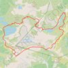
Chain Lakes and Wild Goose Trails Loop
United States > Washington > Whatcom County
From the Heather Meadows area, this loop first drops toward Bagley Dam and the open basin of Bagley Lakes, where Bagley Creek, subalpine meadows, heather, and the slopes of Table Mountain and Mount Herman shape the approach to the Chain Lakes Trail. The setting is one of the signature hiking areas of the upper…
Distance: 12.5 Km • Elevation gain: 623 m • Maximum elevation: 1,666 m

The Golden Cathedral via Golden Cathedral Trail in Glen Canyon National Recreation Area
United States > Utah > Garfield County
The Golden Cathedral Trail in Glen Canyon National Recreation Area offers a unique adventure with sweeping views of Neon Canyon’s surreal landscape. The route takes you through sections of deep sand and slick rock, often requiring off-trail navigation and careful route-finding. Along the way, you’ll cross…
Distance: 7.5 Km • Elevation gain: 143 m • Maximum elevation: 1,718 m
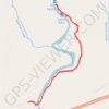
Devil's Kettle Falls via Superior Hiking Trail in Judge C. R. Magney State Park
United States > Minnesota > Cook County
The hike to Devil's Kettle Falls offers a blend of serene forest paths, river views, and the excitement of its famed geological mystery. The trail begins with a gentle incline through dense woodlands, punctuated by occasional river glimpses and resting spots, before reaching the steep staircase that leads to…
Distance: 3.2 Km • Elevation gain: 126 m • Maximum elevation: 254 m

Courthouse Rock via Auxier Ridge Trail in Red River Gorge Geological Area
United States > Kentucky > Powell County
The Auxier Ridge Trail offers a rewarding hike with breathtaking panoramic views, especially as it climbs the narrow ridge toward Courthouse Rock. Along the way, hikers will encounter striking geological features like Haystack Rock and Wizard's Backbone, while experiencing varied landscapes that include lush…
Distance: 6.9 Km • Elevation gain: 256 m • Maximum elevation: 391 m

Turkey Spur Rock via Grandview Rim Trail in New River Gorge National Park and Preserve
United States > West Virginia > Raleigh County > Grandview
The Grandview Rim Trail leading to Turkey Spur Rock offers a truly rewarding hike in New River Gorge National Park. Starting at the Main Overlook, the trail winds through lush forests and along the rim of the gorge, providing frequent stops to admire breathtaking views of the deep river valley below. The…
Distance: 5.5 Km • Elevation gain: 150 m • Maximum elevation: 762 m

San Jacinto Peak via Palm Springs Aerial Tramway, Round Valley Trail and Peak Trail
United States > California > Riverside County
The hike to San Jacinto Peak is a stunning journey through diverse landscapes, starting with a steep ascent that transitions into tranquil alpine meadows. As you make your way through Round Valley and past Wellman Divide, the trail gradually opens to reveal expansive views of the Coachella Valley and…
Distance: 16.9 Km • Elevation gain: 785 m • Maximum elevation: 3,280 m
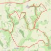
East Riding of Yorkshire Trail Running
United Kingdom > England > East Riding of Yorkshire > Millington > Givendale
Loop run / hike from Givendale via Whitekeld Beck, Deep Dale, Millington Dale, Nettle Dale, Frendal Dale, Fenstone Quarries, Keasey Dale, Carden Dale, Coldwold Farm, Warren Farm, Wan Dale, Millington and Little Givendale Farm. #Running #Hiking #Loop #Coutryside #Nature #River #Forest
Distance: 30.1 Km • Elevation gain: 736 m • Maximum elevation: 239 m

West Fork Trail in Coconino National Forest
United States > Arizona > Coconino County
The West Fork Trail is a captivating hike that offers a blend of scenic beauty and natural history. The trail meanders along the West Fork of Oak Creek, providing stunning views of the red rock cliffs, dense forests of Douglas firs, and vibrant riparian flora. Throughout the route, hikers will encounter…
Distance: 9.7 Km • Elevation gain: 326 m • Maximum elevation: 1,736 m

Deep Woods - Mountain Bike Ride in Pinicon Ridge County Park
United States > Iowa > Linn County
Distance: 3.2 Km • Elevation gain: 65 m • Maximum elevation: 291 m

Deep River Loop Walk near Kennedy Creek
Canada > Ontario > Renfrew County > Deep River
Distance: 3.2 Km • Elevation gain: 39 m • Maximum elevation: 150 m

Deep River Loop Walk near Ottawa River
Canada > Ontario > Renfrew County > Deep River
Distance: 3.1 Km • Elevation gain: 30 m • Maximum elevation: 135 m

Gaspereau River Trail
Canada > Nova Scotia > Municipality of the County of Kings > White Rock
Distance: 8.3 Km • Elevation gain: 211 m • Maximum elevation: 91 m

4 Season Trail: C Loop
Canada > Ontario > Renfrew County > Deep River
Distance: 6.5 Km • Elevation gain: 72 m • Maximum elevation: 135 m

Deep River hiking
Canada > Ontario > Renfrew County > Deep River
Distance: 5.3 Km • Elevation gain: 64 m • Maximum elevation: 149 m

4 Season Trail: B Loop
Canada > Ontario > Renfrew County > Deep River
Distance: 2.7 Km • Elevation gain: 59 m • Maximum elevation: 157 m