Import a GPX file

Claremont trails

Click on a trail to view its statistics, map and profile.
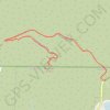
Potato Mountain

United States > California > Los Angeles County > Claremont

Hike to Potato Mountain via the Palmer Evey Trail in the Angeles National Forest. #Hiking #Mountain #Nature #Forest #Angeles

Distance: 3.6 Km • Elevation gain: 338 m • Maximum elevation: 1,036 m

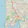
Carine - Kings Park - Claremont

Australia > Western Australia

#Bike #Loop #Kings #Perth

Distance: 52.5 Km • Elevation gain: 426 m • Maximum elevation: 64 m

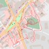
Esher wander

United Kingdom > England > Surrey > Elmbridge > Esher

Distance: 1.8 Km • Elevation gain: 15 m • Maximum elevation: 46 m

Gear up for your next adventure:

⛺Tent Footprint - Protect tent floor and increase durability
🧦Outdoor Socks - Durable socks designed for hiking and outdoor sports
☕Camping Coffee Maker - Brew fresh coffee anywhere on the topographic map
🚲MTB Frame Bag - Carry tools and maps directly on your bicycle frame
🛏️Sleeping Bag - Warm and compact sleeping bags for outdoor camping

As an Amazon Associate, this site earns from qualifying purchases at no extra cost to you.