Import a GPX file

Rangeley trails

Click on a trail to view its statistics, map and profile.
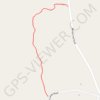
Forest path from North Camps Road to Mingo Loop Road in Rangeley, ME

United States > Maine > Franklin County > Rangeley

Forest, path, rangeley, nature

Distance: 0.6 Km • Elevation gain: 26 m • Maximum elevation: 520 m

Gear up for your next adventure:

🔋Solar Power Bank - Keep your GPS and devices charged during long outdoor trips
🧭GPS Outdoor Watch - Smart watch for navigation and fitness tracking in nature
🕶️Polarized Sunglasses - Reduces glare from snow and water at high elevations
⛺Camping Groundsheet - Protect your tent from moisture and dirt
🧥Softshell Jacket - Windproof and breathable jacket for hiking

As an Amazon Associate, this site earns from qualifying purchases at no extra cost to you.