
Canyon Alpine trails
Click on a trail to view its statistics, map and profile.

Lone Pine Lake
United States > California > Inyo County
Starting at Whitney Portal, a wooded canyon at the end of Whitney Portal Road, the route follows the Mount Whitney Trail past the North Fork of Lone Pine Creek and into the John Muir Wilderness, with granite walls and the Mount Whitney massif framing the ascent. It then climbs through conifer forest on a…
Distance: 4.7 Km • Elevation gain: 549 m • Maximum elevation: 3,067 m
Big Pine Lakes Loop
United States > California > Inyo County
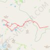
From the Glacier Lodge area, this Big Pine Lakes Loop begins along the North Fork Big Pine Creek Trail, entering the John Muir Wilderness of Inyo National Forest. The route climbs beside North Fork Big Pine Creek through forest and sagebrush slopes before reaching the higher canyon beneath Mount Alice. The…
Distance: 24.5 Km • Elevation gain: 1,235 m • Maximum elevation: 3,432 m

Lake Catherine Loop
United States > Utah > Salt Lake County > Brighton
Starting at Brighton Resort in Big Cottonwood Canyon, the loop leaves the ski-area base and climbs into the Brighton Lakes corridor, crossing open slopes, conifer patches, and a stream-fed drainage on the way toward Lake Mary. Beyond the dam and shoreline of Lake Mary, the route continues into a higher alpine…
Distance: 7.5 Km • Elevation gain: 373 m • Maximum elevation: 3,035 m

Horsetail Falls via Deer Creek-Dry Creek Trail in Lone Peak Wilderness
United States > Utah > Utah County
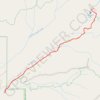
The hike to Horsetail Falls via the Deer Creek-Dry Creek Trail offers a rewarding blend of natural beauty and adventure. The trail meanders through a wooded canyon and opens up to sweeping views of Alpine, Utah Lake, the rugged cliffs of the Lone Peak Wilderness, and nearby peaks like The Pfeifferhorn or White…
Distance: 6.7 Km • Elevation gain: 518 m • Maximum elevation: 2,248 m
Humphreys Peak Trail in Kachina Peaks Wilderness
United States > Arizona > Coconino County
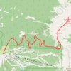
Humphreys Peak Trail, located in the Kachina Peaks Wilderness in Arizona, is a scenic and challenging hike that leads to the state's highest point. As the trail ascends, it traverses alpine meadows, lush forests and ancient volcanic fields, leading to a saddle that reveals panoramic views of the Inner Basin…
Distance: 16.3 Km • Elevation gain: 1,023 m • Maximum elevation: 3,834 m
Lake Mary Dam via Catherine's Pass Trail
United States > Utah > Salt Lake County > Alta
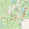
The Lake Mary Dam hike via Catherine’s Pass Trail offers a scenic and rewarding journey through the Uinta-Wasatch-Cache National Forest. Along the way, you'll encounter picturesque alpine lakes such as Lake Mary, Lake Martha, and Lake Catherine, with stunning views of rugged peaks like Mount Millicent. The…
Distance: 9.9 Km • Elevation gain: 538 m • Maximum elevation: 3,116 m
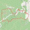
Flagstaff Mountain Loop via Gregory Canyon Trail, Range View Trail and Flagstaff Trail
United States > Colorado > Boulder County
The Flagstaff Mountain Loop offers a memorable hiking experience within Boulder’s iconic foothills. Along the route, hikers are treated to sweeping views of the Flatirons, the city of Boulder below, and lush forested areas, especially as the trail ascends towards Flagstaff Mountain. The diverse scenery…
Distance: 6.5 Km • Elevation gain: 377 m • Maximum elevation: 2,117 m
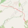
Cucamonga Peak Trail via Icehouse Canyon Trail in Cucamonga Wilderness
United States > California > San Bernardino County
The Cucamonga Peak Trail via Icehouse Canyon offers hikers a rewarding journey through diverse landscapes, culminating in panoramic vistas from the summit. The trail begins in a lush, shaded canyon, following the serene Icehouse Creek and passing remnants of historic stone cabins. As you ascend, the terrain…
Distance: 18.9 Km • Elevation gain: 1,332 m • Maximum elevation: 2,694 m
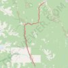
Boston Bar - Spences Bridge
Canada > British Columbia > Fraser Valley Regional District > Area A (Boston Bar/North Bend/Canyon Alpine) > Canyon Alpine
Fraser River. #Bike
Distance: 77.0 Km • Elevation gain: 1,228 m • Maximum elevation: 365 m