
Wallis trails
Click on a trail to view its statistics, map and profile.
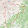
ANZERE_TRAIL DES AUDANNES
Switzerland > Wallis > Hérens > Ayent > Anzère > Les Bochonès
Distance: 25.1 Km • Elevation gain: 1,567 m • Maximum elevation: 2,725 m
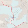
Weissmies
Switzerland > Wallis > Visp > Saas-Grund
Distance: 7.1 Km • Elevation gain: 969 m • Maximum elevation: 3,992 m
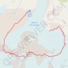
Mont Blanc de Cheilon
Switzerland > Wallis > Hérens > Hérémence
Distance: 9.0 Km • Elevation gain: 978 m • Maximum elevation: 3,847 m
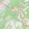
La Voie des Erables
Switzerland > Wallis > Martigny > Riddes
Cet itinéraire permet de découvrir Isérables, son histoire et son architecture en vous guidant à travers champs, forêts et rochers, entre barrières et passerelles.
Distance: 9.8 Km • Elevation gain: 993 m • Maximum elevation: 1,193 m