Import a GPX file

Thunder Bay trails

Click on a trail to view its statistics, map and profile.
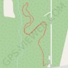
Kamview Nordic Ski Centre

Canada > Ontario > Thunder Bay District > Thunder Bay

#Ski #Snowshoeing

Distance: 3.4 Km • Elevation gain: 27 m • Maximum elevation: 242 m

Kamview Nordic Ski Centre

Canada > Ontario > Thunder Bay District > Thunder Bay

Distance: 3.4 Km • Elevation gain: 27 m • Maximum elevation: 242 m
Gear up for your next adventure:

🧶550 Survival Paracord - Versatile utility cord for emergency repairs and rigging
🔋Solar Power Bank - Keep your GPS and devices charged during long outdoor trips
⛺Lightweight Camping Tent - Portable shelter optimized for Canadian backcountry camping
🏕️Camping Hammock - Integrated protection for sleeping between trees
🥾Lightweight Hiking Boots - Boots for comfort and mobility on long hikes

As an Amazon Associate, this site earns from qualifying purchases at no extra cost to you.