Import a GPX file

Kittery trails

Click on a trail to view its statistics, map and profile.
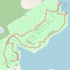
Leland Loop Trail

United States > Maine > York County > Kittery > Kittery Point

Distance: 1.7 Km • Elevation gain: 32 m • Maximum elevation: 18 m
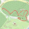
Fort McClary

United States > Maine > York County > Kittery > Kittery Point

Distance: 0.8 Km • Elevation gain: 21 m • Maximum elevation: 19 m

Other places

Gear up for your next adventure:

🥾Trail Hiking Boots - Supportive boots for rough trails
👟Trail Running Shoes - Agile footwear for fast-paced topographic exploration
🛌Down Sleeping Bag - Superior warmth-to-weight ratio for cold nights
⛺Family Camping Tent - Spacious tent suitable for family camping trips
🛁Quick-Dry Microfiber Towel - Space-saving towel that dries rapidly on the move

As an Amazon Associate, this site earns from qualifying purchases at no extra cost to you.