Import a GPX file

Kittery Point trails

Click on a trail to view its statistics, map and profile.
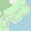
Leland Loop Trail

United States > Maine > York County > Kittery > Kittery Point

Distance: 1.7 Km • Elevation gain: 32 m • Maximum elevation: 18 m
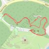
Fort McClary

United States > Maine > York County > Kittery > Kittery Point

Distance: 0.8 Km • Elevation gain: 21 m • Maximum elevation: 19 m

Gear up for your next adventure:

🧢Hiking Sun Hat - Wide-brimmed protection for exposed mountain ridges
👟Trail Running Shoes - Agile footwear for fast-paced topographic exploration
🧥Packable Rain Jacket - Breathable waterproof layer for unpredictable weather
🔋Lithium AA Batteries - Long-lasting power that performs in extreme cold
💡LED Camping Lantern - Illuminate your campsite with long-lasting lanterns

As an Amazon Associate, this site earns from qualifying purchases at no extra cost to you.