Import a GPX file

Curry County trails

Click on a trail to view its statistics, map and profile.
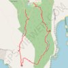
Port Orford Heads State Park Loop

United States > Oregon > Curry County

Loop hike via Tower Trail and Nellies Cove Trail in the Port Orford Heads State Park. #Hiking #Loop #Nature #Sea #Pacific #Ocean #Forest

Distance: 1.2 Km • Elevation gain: 78 m • Maximum elevation: 99 m

Trails at a spot on the Rogue River

United States > Oregon > Curry County

Afternoon Run

Distance: 6.3 Km • Elevation gain: 255 m • Maximum elevation: 166 m

Gear up for your next adventure:

🧭GPS Handheld Device - Reliable GPS navigation for outdoor adventures
🔋Emergency Crank Radio - Weather alerts and power without needing batteries
🪑Ultralight Camping Stool - Compact seating for rest stops during long hikes
🔥Emergency Fire Starter - Reliable ignition source for all weather conditions
🥾Mountain Trail Shoes - High-traction shoes for mountain trails

As an Amazon Associate, this site earns from qualifying purchases at no extra cost to you.