Import a GPX file

Town of Richmond trails

Click on a trail to view its statistics, map and profile.
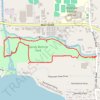
Sandy Bottom Park Nature Loop Trail

United States > New York > Ontario County > Town of Richmond > Honeoye

Distance: 4.1 Km • Elevation gain: 25 m • Maximum elevation: 262 m

Other places

Gear up for your next adventure:

👟Trail Running Shoes - Agile footwear for fast-paced topographic exploration
🕶️Polarized Sunglasses - Reduces glare from snow and water at high elevations
🧭Orienteering Kit - Tools for map reading and navigation in the wild
👖Convertible Hiking Pants - Zip-off legs to adapt to changing weather conditions
🎒Fully Waterproof Backpack - Total protection for photography gear and electronics

As an Amazon Associate, this site earns from qualifying purchases at no extra cost to you.