Import a GPX file

Chale trails

Click on a trail to view its statistics, map and profile.
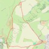
Footpaths and bridleways - St Catherines Down, Isle of Wight

United Kingdom > England > Isle of Wight > Chale > Blackgang

Distance: 5.5 Km • Elevation gain: 184 m • Maximum elevation: 234 m

Other places

Gear up for your next adventure:

🦶Hiking Shoe Insoles - Added support for high arches and long days on feet
🚲Handlebar Phone Mount - View topographic-map.com live while cycling
🏕️Camping Hammock - Integrated protection for sleeping between trees
🛁Quick-Dry Microfiber Towel - Space-saving towel that dries rapidly on the move
🥾Mountain Trail Shoes - High-traction shoes for mountain trails

As an Amazon Associate, this site earns from qualifying purchases at no extra cost to you.