Import a GPX file

Heilwield Corner trails

Click on a trail to view its statistics, map and profile.
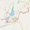
Hiking trail in Zemko Pond Wildlife Management Area

United States > Connecticut > Southeastern Connecticut Planning Region > Salem > Heilwield Corner

Distance: 5.5 Km • Elevation gain: 80 m • Maximum elevation: 176 m

Gear up for your next adventure:

🏕️Camping Hammock - Integrated protection for sleeping between trees
🚲MTB Frame Bag - Carry tools and maps directly on your bicycle frame
🥾Trail Hiking Boots - Supportive boots for rough trails
🧼Travel Hand Sanitizer - Keep hands clean when water is scarce
🧼Biodegradable Camp Soap - Environmentally friendly cleaning for gear and body

As an Amazon Associate, this site earns from qualifying purchases at no extra cost to you.