
Whitegate trails
Click on a trail to view its statistics, map and profile.
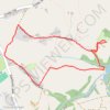
Cedar Lodge - the Plough Inn - Sixes Pool
United Kingdom > England > Cheshire West and Chester > Whitegate > Cassia Green
Footpaths Whitegate - Foxwist Green UK, whitegate, Nortwhich
Distance: 3.0 Km • Elevation gain: 38 m • Maximum elevation: 67 m

Cedar Lodge - Whitegate Way - Grange Lane
United Kingdom > England > Cheshire West and Chester > Whitegate > Cassia Green
UK, Whitegate, Nortwhich
Distance: 5.2 Km • Elevation gain: 64 m • Maximum elevation: 59 m
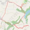
Footpaths Foxwist Green Cedar Lodge
United Kingdom > England > Cheshire West and Chester > Whitegate > Cassia Green
UK, Nortwhich
Distance: 3.4 Km • Elevation gain: 57 m • Maximum elevation: 63 m