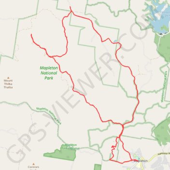
Cedar Creek - Gheerulla
Interactive trail map
Trail profile
- Distance: 34.2 Km
- Elevation gain: 743 m
- Maximum elevation: 464 m
- Elevation loss: 742 m
- Minimum elevation: 95 m
About this trail
Name: Cedar Creek - Gheerulla trail, distance, elevation, map, profile, GPS track
Start: Delicia Road, Mapleton, Sunshine Coast Regional, Queensland, Australia (-26.62435 152.86479)
End: Delicia Road, Mapleton, Sunshine Coast Regional, Queensland, Australia (-26.62433 152.86467)
Coordinates: -26.62569 152.80016 -26.54068 152.86509
Other hiking, mountain biking, running and outdoor activity trails
Click on a trail to view its statistics, map and profile.
Imbil Jimna Kenilworth loop
Australia > Queensland > Tewantin
Distance: 216.0 Km • Elevation gain: 3,884 m • Maximum elevation: 822 m