Munro hillwalk Sgurr nan Eag Sgurr Dubh Mor Sgurr Sgumain
Munro, hillwalk, Sgurr, nan, Eag, Dubh, Mor, Sgurr, Sgumain
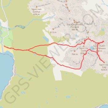
- Distance: 14.9 Km
- Elevation gain: 1,243 m
- Maximum elevation: 919 m
- Elevation loss: 1,243 m
- Minimum elevation: 3 m
- Moving time: 6 h 17 m
- Moving speed: 2.4 Km/h
- Maximum speed: 7.9 Km/h
- Total time: 10 h 15 m
- Global speed: 1.5 Km/h
Interactive trail map
Trail profile
- Distance: 14.9 Km
- Elevation gain: 1,243 m
- Maximum elevation: 919 m
- Elevation loss: 1,243 m
- Minimum elevation: 3 m
- Moving time: 6 h 17 m
- Moving speed: 2.4 Km/h
- Maximum speed: 7.9 Km/h
- Total time: 10 h 15 m
- Global speed: 1.5 Km/h
About this trail
Name: Munro hillwalk Sgurr nan Eag Sgurr Dubh Mor Sgurr Sgumain trail, distance, elevation, map, profile, GPS track
Start: Glen Brittle, Highland, Scotland, IV47 8TA, United Kingdom (57.20285 -6.29141)
End: Glen Brittle, Highland, Scotland, IV47 8TA, United Kingdom (57.20287 -6.29134)
Coordinates: 57.19281 -6.29141 57.20592 -6.21119