Valley Creek Paths
Morning Gravel Ride
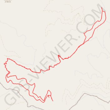
- Distance: 41.1 Km
- Elevation gain: 1,347 m
- Maximum elevation: 1,845 m
- Elevation loss: 1,350 m
- Minimum elevation: 989 m
- Moving time: 3 h 35 m
- Moving speed: 11.4 Km/h
- Maximum speed: 49.0 Km/h
- Total time: 4 h 4 m
- Global speed: 10.1 Km/h
Interactive trail map
Trail profile
- Distance: 41.1 Km
- Elevation gain: 1,347 m
- Maximum elevation: 1,845 m
- Elevation loss: 1,350 m
- Minimum elevation: 989 m
- Moving time: 3 h 35 m
- Moving speed: 11.4 Km/h
- Maximum speed: 49.0 Km/h
- Total time: 4 h 4 m
- Global speed: 10.1 Km/h
About this trail
Name: Valley Creek Paths trail, distance, elevation, map, profile, GPS track
Start: Valley Creek 3000, Sanders County, Montana, United States (47.18349 -114.21532)
End: Valley Creek 3000, Sanders County, Montana, United States (47.18377 -114.21520)
Coordinates: 47.12816 -114.31570 47.19261 -114.21445
Other hiking, mountain biking, running and outdoor activity trails
Click on a trail to view its statistics, map and profile.
Bushwhacking above Frenchtown
United States > Montana > Missoula County
Distance: 49.4 Km • Elevation gain: 1,604 m • Maximum elevation: 1,863 m