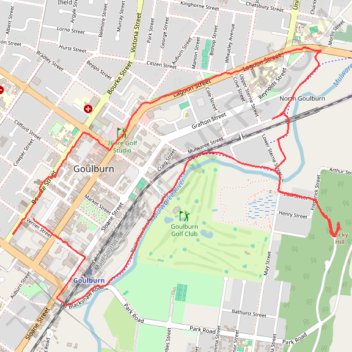
Goulburn sightseeing
- Distance: 8.1 Km
- Elevation gain: 131 m
- Maximum elevation: 709 m
- Elevation loss: 130 m
- Minimum elevation: 624 m
- Moving time: 52 m 32 s
- Moving speed: 9.3 Km/h
- Maximum speed: 19.5 Km/h
- Total time: 1 h 7 m
- Global speed: 7.2 Km/h
Interactive trail map
Trail profile
- Distance: 8.1 Km
- Elevation gain: 131 m
- Maximum elevation: 709 m
- Elevation loss: 130 m
- Minimum elevation: 624 m
- Moving time: 52 m 32 s
- Moving speed: 9.3 Km/h
- Maximum speed: 19.5 Km/h
- Total time: 1 h 7 m
- Global speed: 7.2 Km/h
About this trail
Name: Goulburn sightseeing trail, distance, elevation, map, profile, GPS track
Coordinates: -34.76025 149.71417 -34.74543 149.73705
Other hiking, mountain biking, running and outdoor activity trails
Click on a trail to view its statistics, map and profile.