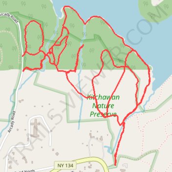
Kitchawan Nature Preserve trails
- Distance: 8.9 Km
- Elevation gain: 157 m
- Maximum elevation: 122 m
- Elevation loss: 157 m
- Minimum elevation: 65 m
- Moving time: 1 h 46 m
- Moving speed: 5.0 Km/h
- Maximum speed: 12.0 Km/h
- Total time: 1 h 57 m
- Global speed: 4.6 Km/h
Interactive trail map
Trail profile
- Distance: 8.9 Km
- Elevation gain: 157 m
- Maximum elevation: 122 m
- Elevation loss: 157 m
- Minimum elevation: 65 m
- Moving time: 1 h 46 m
- Moving speed: 5.0 Km/h
- Maximum speed: 12.0 Km/h
- Total time: 1 h 57 m
- Global speed: 4.6 Km/h
About this trail
Name: Kitchawan Nature Preserve trails trail, distance, elevation, map, profile, GPS track
Coordinates: 41.22058 -73.79472 41.23133 -73.78325
Other hiking, mountain biking, running and outdoor activity trails
Click on a trail to view its statistics, map and profile.