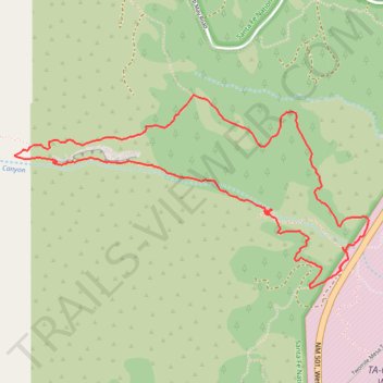
Loop, Nail trail to Pajarito Canyon
- Distance: 6.5 Km
- Elevation gain: 234 m
- Maximum elevation: 2,570 m
- Elevation loss: 233 m
- Minimum elevation: 2,371 m
- Moving time: 2 h 13 m
- Moving speed: 2.9 Km/h
- Maximum speed: 6.4 Km/h
- Total time: 2 h 39 m
- Global speed: 2.4 Km/h
Interactive trail map
Trail profile
- Distance: 6.5 Km
- Elevation gain: 234 m
- Maximum elevation: 2,570 m
- Elevation loss: 233 m
- Minimum elevation: 2,371 m
- Moving time: 2 h 13 m
- Moving speed: 2.9 Km/h
- Maximum speed: 6.4 Km/h
- Total time: 2 h 39 m
- Global speed: 2.4 Km/h
About this trail
Name: Loop, Nail trail to Pajarito Canyon trail, distance, elevation, map, profile, GPS track
Start: Perimeter Trail, Los Alamos County, New Mexico, 87545, United States (35.86667 -106.35309)
End: Perimeter Trail, Los Alamos County, New Mexico, 87545, United States (35.86675 -106.35310)
Coordinates: 35.86575 -106.37329 35.87543 -106.35141