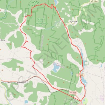
Looking for a gravel climb
- Distance: 47.6 Km
- Elevation gain: 900 m
- Maximum elevation: 751 m
- Elevation loss: 893 m
- Minimum elevation: 311 m
- Moving time: 2 h 17 m
- Moving speed: 20.7 Km/h
- Maximum speed: 49.5 Km/h
- Total time: 2 h 38 m
- Global speed: 18.0 Km/h
Interactive trail map
Trail profile
- Distance: 47.6 Km
- Elevation gain: 900 m
- Maximum elevation: 751 m
- Elevation loss: 893 m
- Minimum elevation: 311 m
- Moving time: 2 h 17 m
- Moving speed: 20.7 Km/h
- Maximum speed: 49.5 Km/h
- Total time: 2 h 38 m
- Global speed: 18.0 Km/h
About this trail
Name: Looking for a gravel climb trail, distance, elevation, map, profile, GPS track
Coordinates: 43.41994 -72.82864 43.56126 -72.69814
Other hiking, mountain biking, running and outdoor activity trails
Click on a trail to view its statistics, map and profile.