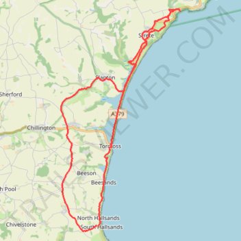
Torcross
- Distance: 29.3 Km
- Elevation gain: 801 m
- Maximum elevation: 138 m
- Elevation loss: 793 m
- Minimum elevation: -2 m
- Moving time: 7 h 32 m
- Moving speed: 3.9 Km/h
- Maximum speed: 28.9 Km/h
- Total time: 8 h 26 m
- Global speed: 3.5 Km/h
Interactive trail map
Trail profile
- Distance: 29.3 Km
- Elevation gain: 801 m
- Maximum elevation: 138 m
- Elevation loss: 793 m
- Minimum elevation: -2 m
- Moving time: 7 h 32 m
- Moving speed: 3.9 Km/h
- Maximum speed: 28.9 Km/h
- Total time: 8 h 26 m
- Global speed: 3.5 Km/h
About this trail
Name: Torcross trail, distance, elevation, map, profile, GPS track
Coordinates: 50.23241 -3.68359 50.32001 -3.61026