Odyssey and Desert Peach Loop via Riverview Park
- Distance: 25.0 Km
- Elevation gain: 359 m
- Maximum elevation: 1,664 m
- Elevation loss: 359 m
- Minimum elevation: 1,399 m
- Moving time: 1 h 32 m
- Moving speed: 16.2 Km/h
- Maximum speed: 44.1 Km/h
- Total time: 1 h 40 m
- Global speed: 15.0 Km/h
Interactive trail map
Trail profile
- Distance: 25.0 Km
- Elevation gain: 359 m
- Maximum elevation: 1,664 m
- Elevation loss: 359 m
- Minimum elevation: 1,399 m
- Moving time: 1 h 32 m
- Moving speed: 16.2 Km/h
- Maximum speed: 44.1 Km/h
- Total time: 1 h 40 m
- Global speed: 15.0 Km/h
About this trail
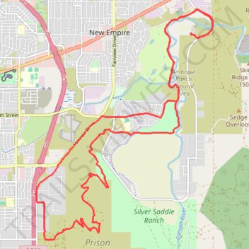
Name: Odyssey and Desert Peach Loop via Riverview Park trail, distance, elevation, map, profile, GPS track
Start: North Deer Run Road, Carson City, Nevada, United States (39.17917 -119.70196)
End: North Deer Run Road, Carson City, Nevada, United States (39.17944 -119.70192)
Coordinates: 39.13368 -119.74609 39.18468 -119.69570