
Big Schloss via Mill Mountain Trail in Wardensville Wildlife Management Area
Hiking Big Schloss is a memorable journey through a ridge that reveals sweeping views of the Shenandoah Valley and the distant Great North Mountain. The trail weaves through dense hardwoods and rocky terrain, offering intermittent glimpses of the landscape before culminating in a summit with castle-like boulders and a stunning panorama. It's a peaceful, nature-rich experience that leaves you feeling connected to the vast beauty of the George Washington National Forest and Wardensville Wildlife Area. #Hiking #Mountain #Forest #Nature
- Distance: 7.1 Km
- Elevation gain: 312 m
- Maximum elevation: 871 m
- Elevation loss: 313 m
- Minimum elevation: 682 m
- Moving time: 1 h 52 m
- Moving speed: 3.8 Km/h
- Maximum speed: 10.5 Km/h
- Total time: 2 h 52 m
- Global speed: 2.5 Km/h
Interactive trail map
Trail profile
- Distance: 7.1 Km
- Elevation gain: 312 m
- Maximum elevation: 871 m
- Elevation loss: 313 m
- Minimum elevation: 682 m
- Moving time: 1 h 52 m
- Moving speed: 3.8 Km/h
- Maximum speed: 10.5 Km/h
- Total time: 2 h 52 m
- Global speed: 2.5 Km/h
About this trail
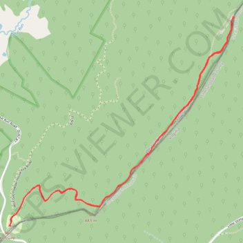
Name: Big Schloss via Mill Mountain Trail in Wardensville Wildlife Management Area trail, distance, elevation, map, profile, GPS track
Start: Wolf Gap Campground, Hardy County, West Virginia, United States (38.92443 -78.68922)
End: Wolf Gap Campground, Hardy County, West Virginia, United States (38.92443 -78.68936)
Coordinates: 38.92443 -78.68936 38.94139 -78.66596