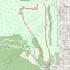
Anemone Point and Reflection Point Loop (Boulder)
Loop hike from The Peoles' Crossing to Anemone Point and Reflection Point via Red Rocks Trail, Anemone Loop Trail and Red Rocks Spur Trail in the Boulder Open Space and Mountain Parks. #Hiking #Loop #Nature #Mountain #Forest #Park #Overlook
- Distance: 7.7 Km
- Elevation gain: 336 m
- Maximum elevation: 1,939 m
- Elevation loss: 338 m
- Minimum elevation: 1,660 m
- Moving time: 1 h 41 m
- Moving speed: 4.5 Km/h
- Maximum speed: 13.2 Km/h
- Total time: 2 h 4 m
- Global speed: 3.7 Km/h
Interactive trail map
Trail profile
- Distance: 7.7 Km
- Elevation gain: 336 m
- Maximum elevation: 1,939 m
- Elevation loss: 338 m
- Minimum elevation: 1,660 m
- Moving time: 1 h 41 m
- Moving speed: 4.5 Km/h
- Maximum speed: 13.2 Km/h
- Total time: 2 h 4 m
- Global speed: 3.7 Km/h
About this trail
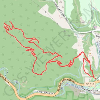
Name: Anemone Point and Reflection Point Loop (Boulder) trail, distance, elevation, map, profile, GPS track
Start: Red Rocks Trail, Boulder, Boulder County, Colorado, 80302, United States (40.01423 -105.29576)
Coordinates: 40.01421 -105.31151 40.02179 -105.29548
Other hiking, mountain biking, running and outdoor activity trails
Click on a trail to view its statistics, map and profile.
Mount Sanitas Trail in City of Boulder Open Space and Mountain Parks
United States > Colorado > Boulder County > Boulder
The Mount Sanitas Trail in Boulder offers a rewarding and scenic hike with stunning views of both the city and the rugged Front Range. As you ascend, you'll encounter a mix of wooded areas, rocky steps, and exposed ridges, with the summit providing panoramic vistas that include Boulder to the east and the…
Distance: 4.1 Km • Elevation gain: 375 m • Maximum elevation: 2,061 m
Mount Sanitas and Sanitas Valley Loop
United States > Colorado > Boulder County > Boulder
The Mount Sanitas and Sanitas Valley Loop offers a rewarding hike with a combination of steep ascents, scenic overlooks, and diverse terrain. The route begins with the Sanitas Valley Trail, which meanders through open valleys, providing expansive views of the Boulder foothills. Once you begin the climb toward…
Distance: 5.1 Km • Elevation gain: 384 m • Maximum elevation: 2,061 m