Import a GPX file

Route von Oberalm nach/zu Gaisberg (1287 m)

  • Distance: 22.5 Km
  • Elevation gain: 910 m
  • Maximum elevation: 1,286 m
  • Elevation loss: 78 m
  • Minimum elevation: 420 m

Interactive trail map

Trail profile

  • Distance: 22.5 Km
  • Elevation gain: 910 m
  • Maximum elevation: 1,286 m
  • Elevation loss: 78 m
  • Minimum elevation: 420 m

About this trail
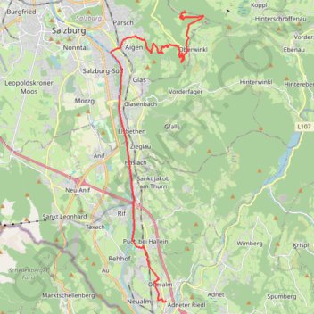
Name: Route von Oberalm nach/zu Gaisberg (1287 m) trail, distance, elevation, map, profile, GPS track

Start: 30, Hammerstraße, Oberalm, Bezirk Hallein, Salzburg, 5411, Austria (47.69334 13.10218)

End: Route 13, Gaisberg, Guggenthal, Salzburg, Bezirk Salzburg-Umgebung, Salzburg, 5321, Austria (47.80512 13.11273)

Coordinates: 47.69325 13.07038 47.80512 13.12361

Gear up for your next adventure:

🧰Survival Kit - Essential gear for emergencies in the wilderness
🧥Softshell Hiking Jacket - The perfect balance of wind protection and breathability
🚲MTB Frame Bag - Carry tools and maps directly on your bicycle frame
🧦Merino Wool Socks - Moisture-wicking comfort for long-distance hiking
👟Leg Gaiters - Keep debris, mud, and snow out of your boots

As an Amazon Associate, this site earns from qualifying purchases at no extra cost to you.