Make a donation
Gear up for your next adventure:
As an Amazon Associate, this site earns from qualifying purchases at no extra cost to you.
Indian Head Mountain
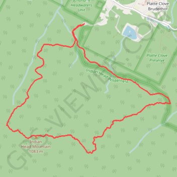
Interactive trail map
Make a donation
Gear up for your next adventure:
As an Amazon Associate, this site earns from qualifying purchases at no extra cost to you.
Trail profile
- Distance: 9.8 Km
- Elevation gain: 515 m
- Maximum elevation: 1,076 m
- Elevation loss: 515 m
- Minimum elevation: 617 m
Make a donation
Gear up for your next adventure:
As an Amazon Associate, this site earns from qualifying purchases at no extra cost to you.
About this trail
Name: Indian Head Mountain trail, distance, elevation, map, profile, GPS track
Start: Devil's Path, Town of Hunter, Greene County, New York, 12427, United States (42.13399 -74.10429)
End: Devil's Path, Town of Hunter, Greene County, New York, 12427, United States (42.13400 -74.10435)
Coordinates: 42.11366 -74.12078 42.13400 -74.08606
Make a donation
Gear up for your next adventure:
As an Amazon Associate, this site earns from qualifying purchases at no extra cost to you.