Donner Canyon Road, Middle Trail and Falls Trail Loop in Mount Diablo State Park
The Donner Canyon Road, Middle Trail, and Falls Trail Loop in Mount Diablo State Park offers hikers a diverse experience, featuring open meadows, oak woodlands, and waterfalls cascading over multicolored rock formations, especially vibrant after seasonal rains. As you ascend, you'll be rewarded with panoramic vistas of the surrounding mountains like Mount Diablo and Eagle Peak, and, on clear days, distant cityscapes, making the challenging sections worthwhile. #Hiking #Mountain #Forest #Nature #Loop #Waterfall
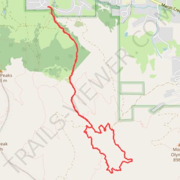
- Distance: 8.9 Km
- Elevation gain: 445 m
- Maximum elevation: 514 m
- Elevation loss: 443 m
- Minimum elevation: 164 m
- Moving time: 2 h 9 m
- Moving speed: 4.1 Km/h
- Maximum speed: 13.8 Km/h
- Total time: 2 h 33 m
- Global speed: 3.5 Km/h
Interactive trail map
Trail profile
- Distance: 8.9 Km
- Elevation gain: 445 m
- Maximum elevation: 514 m
- Elevation loss: 443 m
- Minimum elevation: 164 m
- Moving time: 2 h 9 m
- Moving speed: 4.1 Km/h
- Maximum speed: 13.8 Km/h
- Total time: 2 h 33 m
- Global speed: 3.5 Km/h
About this trail
Name: Donner Canyon Road, Middle Trail and Falls Trail Loop in Mount Diablo State Park trail, distance, elevation, map, profile, GPS track
Coordinates: 37.89658 -121.92828 37.92226 -121.91177
Other hiking, mountain biking, running and outdoor activity trails
Click on a trail to view its statistics, map and profile.
5 Peaks Loop (Mount Olympia, North Peak, Mount Diablo, Eagle Peak and Twin Peaks)
United States > California > Contra Costa County > Clayton
Loop hike from Clayton via Donner Canyon Road, Cardinet Oaks Road, Mount Olympia Road, Mount Olympia, North Peak Road, North Peak, Prospectors Gap, North Peak Trail, Summit Trail, Mount Diablo, Bald Ridge Trail, Eagle Peak Trail, Eagle Peak, Mitchell Rock Trail, Twin Peaks, Mitchell Rock, Oak Road and Murchio…
Distance: 24.2 Km • Elevation gain: 1,543 m • Maximum elevation: 1,152 m