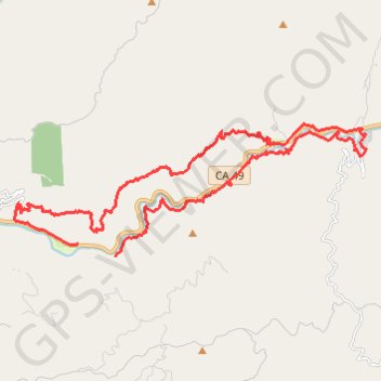
North Yuba River MTB Loop
Interactive trail map
Trail profile
- Distance: 32.0 Km
- Elevation gain: 1,852 m
- Maximum elevation: 1,253 m
- Elevation loss: 1,888 m
- Minimum elevation: 698 m
About this trail
Name: North Yuba River MTB Loop trail, distance, elevation, map, profile, GPS track
End: CA 49, Goodyears Bar, Sierra County, California, United States (39.51383 -120.97626)
Coordinates: 39.51061 -120.99676 39.54314 -120.88427